HoliTracer: Holistic Vectorization of Geographic Objects from Large-Size Remote Sensing Imagery
Abstract
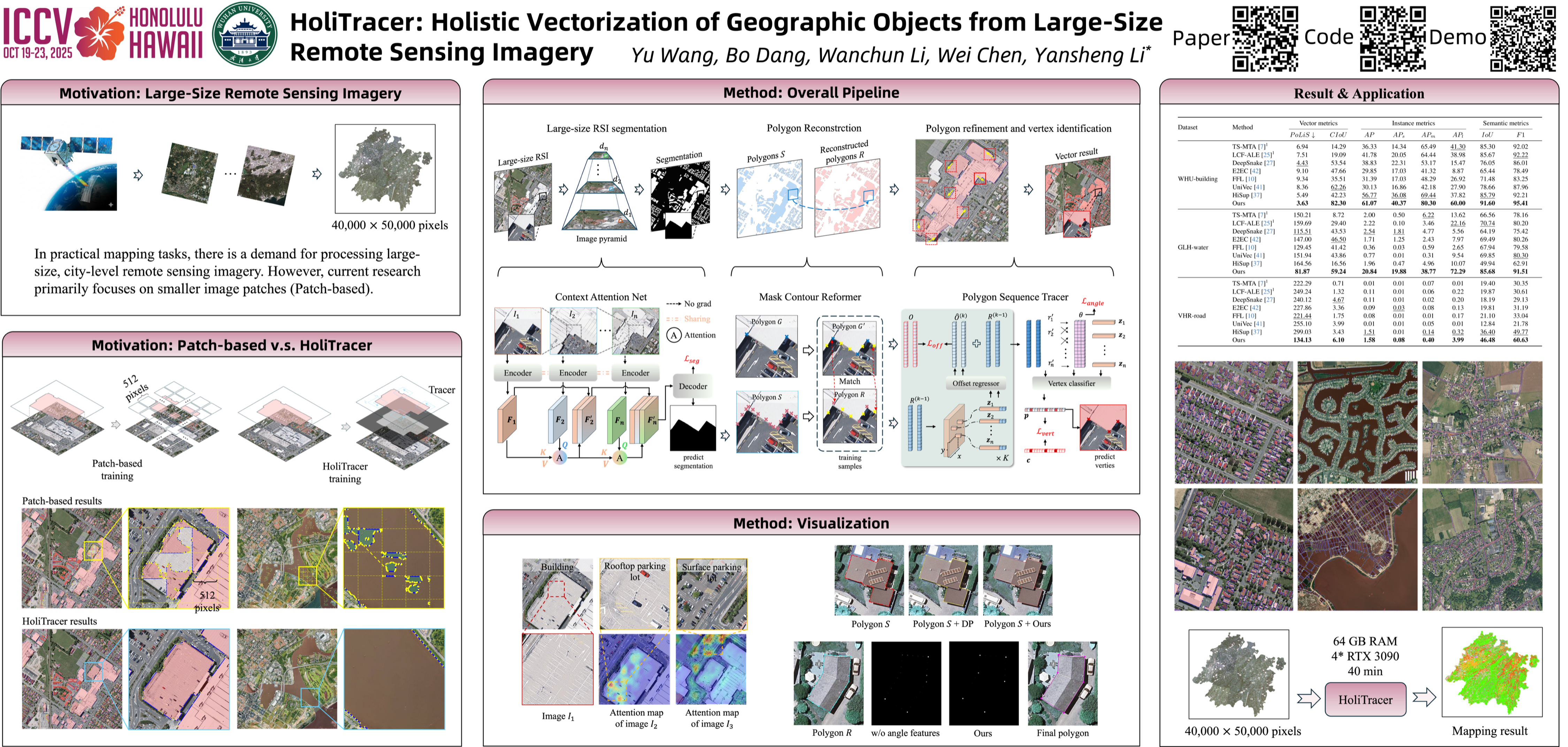
With the increasing resolution of remote sensing imagery (RSI), large-size RSI has emerged as a vital data source for high-precision vector mapping of geographic objects. Existing methods are typically constrained to processing small image patches, which often leads to the loss of contextual information and produces fragmented vector outputs. To address these, this paper introduces \textbf{HoliTracer}, the first framework designed to holistically extract vectorized geographic objects from large-size RSI. In HoliTracer, we enhance segmentation of large-size RSI using the Context Attention Net (CAN), which employs a local-to-global attention mechanism to capture contextual dependencies. Furthermore, we achieve holistic vectorization through a robust pipeline that leverages the Mask Contour Reformer (MCR) to reconstruct polygons and the Polygon Sequence Tracer (PST) to trace vertices. Extensive experiments on large-size RSI datasets, including buildings, water bodies, and roads, demonstrate that HoliTracer outperforms state-of-the-art methods. Our code will be made publicly available.